In the spring of 2010, anxiety flooded down Florida’s western coast as computer projections put the region in the path of the Deepwater Horizon oil spill. Fear of the deadly explosion and the spectre of oil-covered seabirds, dying dolphins, and tar-splattered beaches flowed over the region for days.
But these horrors fell on other areas along the Gulf of Mexico instead.
The imperfect forecasts highlighted the challenges in plotting the complex movement of oil spills in the real ocean environment. The process combines oceanography, meteorology, and physical–chemical weathering sciences as well as the forces at work at the interface of the three.
A new study from Anthropocene Coasts aims to improve the ability to predict the spread of an oil slick in this dynamic ocean environment.
Predicting the speed and trajectory of an oil slick can be immensely difficult, and imperfect forecasts in urgent situations are expected. Still, they not only divert scarce emergency resources, but also impact regions that seemingly escape the devastation. Adverse publicity, for example, can depress tourism and other businesses well after the disaster.
Scientists around the world are looking at many aspects of the issue, but a group at the Bedford Institute of Oceanography (BIO) in Nova Scotia may have defined a significant cause of the miscalculations and developed a technique to address it using imaging data of the Deepwater Horizon spill collected in 2010 by Canada’s remote-sensing satellite RADARSAT.
In the new study, the researchers describe how an oil slick mitigates the impact of surface wind on ocean movement, specifically on what is known as the Ekman current. This force manifests itself in both the speed and direction of oil-covered waters.
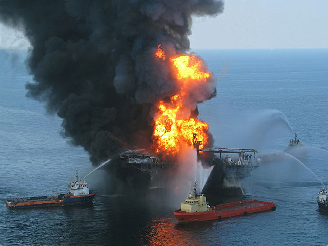
The Deepwater Horizon drilling rig in flames after the 2010 explosion | Wikimedia Commons
For centuries, mariners have known that oil slicks can calm rough seas, and some modest allowance is made for this phenomenon in battling oil slicks. But the BIO researchers found that the drag coefficient, which is a measure of the ocean surface resistance to wind, can be reduced by a factor of 50%–100% in oil-covered water compared with normal oil-free conditions.
In response, researchers propose to replace the surface wind speed with a forcing variable that they call “effective wind speed” to better calculate the movement of ocean waters under an oil spill. This is numerically less than the wind would be in oil-free conditions because of the mitigating effect of the spilt oil on the Ekman current.
“The effective wind speed thus represents the actual power from the wind to drive the ocean current,” said Dr. Hui Shen of Canada’s Department of Fisheries and Oceans, one of the report’s authors.
This, as it turns out, is something that can be derived in near real time, using RADARSAT’s Synthetic Aperture Radar technology, which measures ocean surface roughness all day and night and in all weather conditions. Thus, scientists can determine the effective wind speed that can then be inserted into existing oil spill model systems.
The paper not only describes the new concept, the underpinning data sources and methodology, and significance, but also reviews the other forces at work in ocean currents, the complexity of their interactions, and the residual uncertainty in oil-slick prediction. This, in sum, argues for the prevention of another Deepwater Horizon.
Read the full study: Wind drag in oil spilled ocean surface and its impact on wind-driven circulation in Anthropocene Coasts.